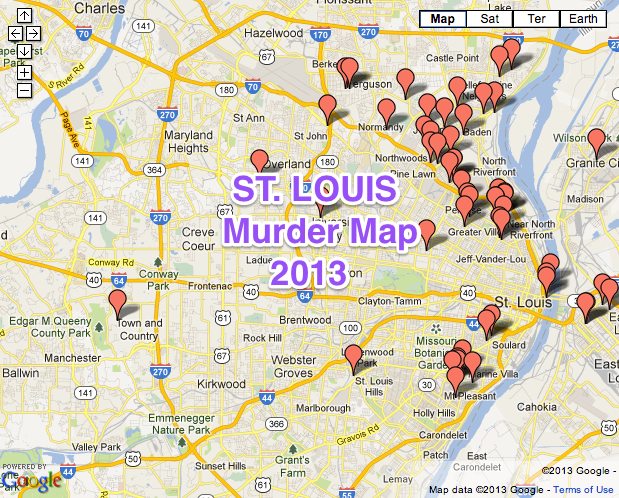
The St. Louis Post Dispatch recently published a map showing the murders in the St. Louis area since the beginning of 2013.
The map excludes police officer-involved shootings and justifiable homicides. Click on a marker for more details and links to the Post-Dispatch’s coverage of the incident.
View 2013 ST. LOUIS-AREA MURDER MAP in a larger map
Crime maps like this one really help home buyers and area residents understand if they will feel safe in a particular part of St. Louis.
I’m thrilled the Post Dispatch put this map together. It would be even better if they would add other violent crimes to the map such as rape, burglary and shootings. By using different colored pins on the map, it would be very easy to identify the type of violent crime and which parts of town residents want to avoid.
St. Louis gets a bad rap in national news on crime rate rankings due to the city – county split.
Most of the national crime rankings sites admit that they only use the data from St. Louis City since our area has 91 municipalities plus unincorporated areas in St. Louis County, plus the region includes several other Missouri counties or portions of southwestern Illinois. The result is that the national crime ranking sites look at just the urban core of the city for St. Louis, while the other cities it is compared to include the urban areas and the suburbs.
The St. Louis Post Dispatch murder map is a start in demonstrating that violent crime is focused in a few parts of town, and rarely occurs in the rest of the St. Louis region.